Mt. Washington is part of the Presidential Range in the White Mountains of New Hampshire. It is the highest peak in the Northeast but it is best known for some of the worst weather in the world. Extremely high winds, cold temps and very little visibility are always a possibility. This is often the biggest challenge when you are attempting a climb to the 6, 288' rugged summit. The weather report for Sept.9th was for high winds with a chill factor in the low 30's but clear. So the trip was on. I packed my wool underwear, rain gear, winter hat , gloves and a coat.

There are many trails one can choose to ascend to the top. I wanted a loop trail and one that was easier terrain coming down than going up and also a trail that allowed maximum views going and coming. I chose to go up the west side using the Ammonoosuc Ravine and Jewell Trail Loop. This is a 9 mile loop and according to most guide books it should take 8-9 hours. ( I think the authors are all long legged and 25 years of age.)
In several of the pics you can see the famous Mt. Washington Resort in the distance. The hike up is along a very fast moving stream with several waterfalls. Every 50 feet you want to stop and take pictures. (Or is that my fast pulse and sore knees that are saying stop?)


 This is the trail? Only for a short way. Better have good gripping boots.
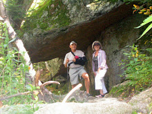
The Presidential Range is known for its chain of hostels, each a day's hike apart. They are set up for dinner and breakfast. The largest of these is the Lakes of the Clouds Hut. I spent about 30 minutes here watching the helicopter bring in new fuel and food and take away the trash and empty tanks. Click on the video.

From this Hut the summit is about 1.6miles and 1200 more feet of elevation.
 Above is looking back to the hut I am about 0.6 miles to the summit.
 Nearing the top! 0.2 Wow what a view!

 The Summit! Five hours of hiking in perfect weather. 50 degrees, no wind, 90 miles visibility. After lunch and a nap I headed back to the trail.
The trip down is less steep but a bit longer than the trip up. It will take me 5 hours to cover the 5.2 miles.
Along the way I crossed the Cog railway and saw a car going down and later one going up.


 Much of this trail is above tree line allowing great views. This view is looking south to Mt. Monroe. The next one is looking north.

Now we are looking west. The bare spot way in the bottom is the base station where I'm headed. Still over 3 miles to go.

Back in the trees. We have to cross this stream then .3 miles to go.
 That's my car. First in (7:30 AM) last out (6:30PM). Right above the tallest pine tree is the top of Mt. Washington.
 What a great hike!